
Fox News Flash top headlines for May 6
Fox News Flash top headlines are here. Check out what's clicking on Foxnews.com.
Millions of people in the central United States must brace themselves for powerful storms that may include long-track tornadoes, hurricane-force winds and baseball-sized hail, forecasters said Monday, issuing a rare high risk warning for central Oklahoma and southern Kansas.
Much of Oklahoma and parts of Kansas are at the greatest risk of bad weather — including areas in Oklahoma, such as Sulphur and Holdenville, still recovering from a tornado that killed four and left thousands without power late last month. Both the Plains and Midwest have been hammered by tornadoes this spring.
The National Weather Service said that more than 3.4 million people, 1,614 schools and 159 hospitals in Oklahoma, portions of southern Kansas and far north Texas, face the most severe threat for tornadoes.
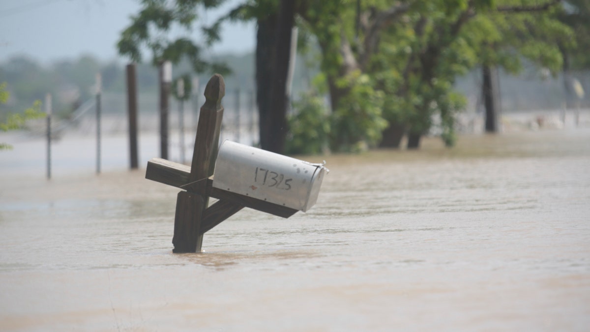
A mailbox is partially submerged on a flooded street in an unincorporated area in east Harris County near Houston on Sunday morning, May 5, 2024. The nearby San Jacinto River, overflowing due to heavy rainfall earlier this week, caused the flood waters. (AP Photo/Lekan Oyekanmi)
In all, nearly 10 million people live in areas that could be affected, the National Weather Service’s Storm Prediction Center said.
Schools and colleges across the state, including the University of Oklahoma, Oklahoma City Public Schools and several metro-area school districts, shut down early and canceled late afternoon and evening classes and activities.
Oklahoma’s State Emergency Operations Center, which coordinates storm response from a bunker near the state Capitol, remains activated from last weekend’s deadly storms, and the state’s commissioner of public safety told state agencies to let most of their workers across Oklahoma leave early on Monday.
Monte Tucker, a farmer and rancher in the far western Oklahoma town of Sweetwater, spent Monday putting some of his tractors and heavy equipment in barns to protect it from potential hail and letting his neighbors know they can come to his house if the weather becomes dangerous.
"We built a house 10 years ago, and my stubborn wife put her foot down and made sure we built a safe room," Tucker said. He said the entire ground-level room is built with reinforced concrete walls.
Tucker said there’s not much you can do to protect cattle from severe storms, but he said the animals tend to know when the weather turns threatening.
Bill Bunting, deputy director of the Storm Prediction Center, said a high risk from the center is not something seen every day or every spring.
"It’s the highest level of threat we can assign. And it’s a day to take very, very seriously," he said.
The last time a high risk was issued was March 31, 2023, when a massive storm system tore through parts of the South and Midwest including Arkansas, Illinois and rural Indiana.
The risk on Monday in parts of the southern Plains is the worst in five years, AccuWeather Chief Meteorologist Jon Porter said.
"If you look at a meteorology textbook about how to get a significant tornado outbreak in the southern Plains, all the ingredients you need are here today," Porter said.
Cities that could see stormy weather include Kansas City, Missouri, and Lincoln, Nebraska.
The number of storms and their intensity should increase quickly in the evening hours across western parts of Oklahoma and up into south-central Kansas, Bunting said.
The expected thunderstorms could produce winds up to and potentially exceeding 80 mph (49.71 kph), according to Porter. Even worse, those "supercell" storms can produce destructive tornadoes.
"The kinds of tornadoes that this storm can produce are particularly intense, and they can be long-lasting," Porter said. "These are the tornadoes that sometimes can last for 45 minutes or an hour, even more, creating paths of destruction as they move along."
The high risk is due to an unusual confluence: Winds gusting up to around 75 mph (46.60 kph) have been blasting through Colorado’s populated Front Range region, including the Denver area, on Monday.
The winds are being created by a low pressure system north of Colorado that is also pulling up moisture from the Gulf of Mexico, fueling the risk of severe weather on the Plains, said Greg Heavener, warning coordination meteorologist at the National Weather Service’s Denver-area office.
Colorado is not at risk of tornadoes or thunderstorms, he said.
The dangerous Plains weather will move east, potentially creating overnight risk in places like Kansas City and Springfield in Missouri through early Tuesday, Porter said.
"This is not going to be a atmospheric setup where the sun is going to go down and the thunderstorms are going to wane and there’s going to be no additional risk," noted Northern Illinois University meteorology professor Victor Gensini. "The risk for tornadoes tonight will continue into the evening and overnight hours making it very challenging."
The entire week is looking stormy across the U.S. The eastern U.S. and the South are expected to get the brunt of the bad weather through the rest of the week, including in Indianapolis, Memphis, Nashville, St. Louis and Cincinnati, where more than 21 million people live. It should be clear over the weekend.
CLICK HERE TO GET THE FOX NEWS APP
Meanwhile, early Monday heavy rains hit southwestern Texas, especially the Houston area, leaving neighborhoods flooded and leading to hundreds of high-water rescues.
Bunting advises people in the affected areas to develop a severe weather plan.
"Make sure that you have ways to communicate with your family members," he said. "Make sure everyone knows where their shelters are," and how they can continue to receive warnings.

The hottest stories ripped from the headlines, from crime to courts, legal and scandal.
