Google Maps update makes it easier to walk through New York and three other major cities

Google Maps, once again, is being updated to include more accurate information about local streets including crosswalks and a crossing island. The latter provides a safe space where pedestrians can protect themselves while crossing a road with multiple lanes. Right now, this detailed information is available for only four cities: London, England; New York, U.S.; San Francisco, U.S.; and Tokyo, Japan.
According to Google, you can check out the new look for the streets in these cities by opening the Google Maps app on your phone. Type in directions to one of those places and keep zooming in to you hit street level. You should see more accurately scaled road widths, pathways, stairs, sidewalks, crosswalks, medians and pedestrian islands. Stairs will be shown in gray to alert those using a wheelchair or pushing a stroller. In parks, the real width of pathways will be shown in dark green.
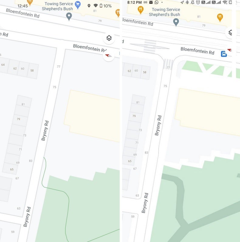
London on Google Maps; at left is the view before the update, at right is updated street level
We would imagine that Google will eventually add more cities to the list. We should let you know that this is apparently a server-side update and the version of Google Maps that you're using, and whether it is a beta variant or not, doesn't matter.

Popular stories


Latest News


Things that are NOT allowed: